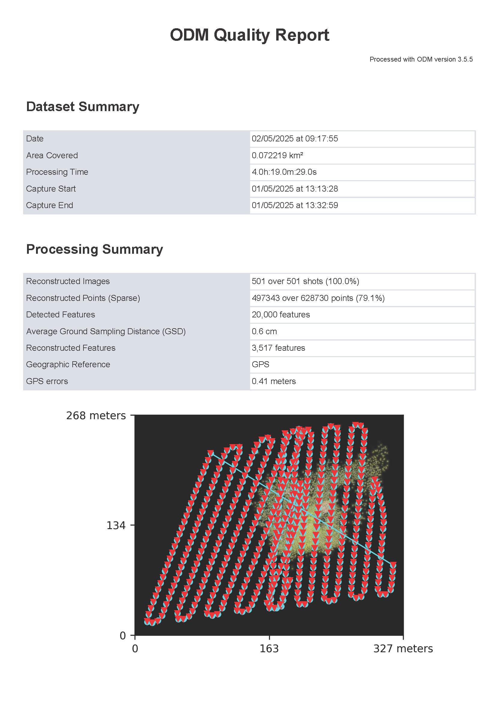
I did a forestry area yesterday with my DJI Mavic 3M. At past I did a flight with 90 degree nadir and a second with 80 degree and 20deg. angle of route for a orthophoto. Now I must fly a area and part this in two separate areas. In DJI I will get two folders like before. Now I will create a orthophoto and render 501 JPG images. I´ve open the folder, group these two folders in a subfolder and select only all JPGs for import.
After 4 hours processing I will get an ortho with half of my area? The routes are slightly changed in angle, but same altitude and GSD.
It is the same like here: Using Images from Multiple Missions - #4 by Aeret
I think it´s auto-boundary:true - ???
Is it possible to combine different orthophotos processed with WebODM.
e.g. Area1, Area2, Area3
Result a merged photo of these three areas. I´ve render a orthophoto with auto-boundary:true and orthophoto_cutline: True.
how will WebODM define the cutline? sharpness? And I must clip the raster file with the cutline in QGIS?
No, mosiacing of final products is not something WebODM is designed to do. They will lack sufficient overlap/sidelap to be appropriate for Structure From Motion photogrammetry.
Any chance to process multiple missions in one task? My areas (about 10) are all with different flightdirections, but all at same altitude and from same day. but different folders with JPG/TIF and RTK geotaggs. The areas are all overlap to each other with about 20-30m.
These are my RGB settings:
auto-boundary:true, dem-resolution:2.0, dsm:true, dtm:true, fast-orthophoto:true, feature-quality:ultra, min-num-features:24000, no-gpu:true, orthophoto-cutline:true, orthophoto-resolution:0.4, pc-quality:high, skip-3dmodel:true
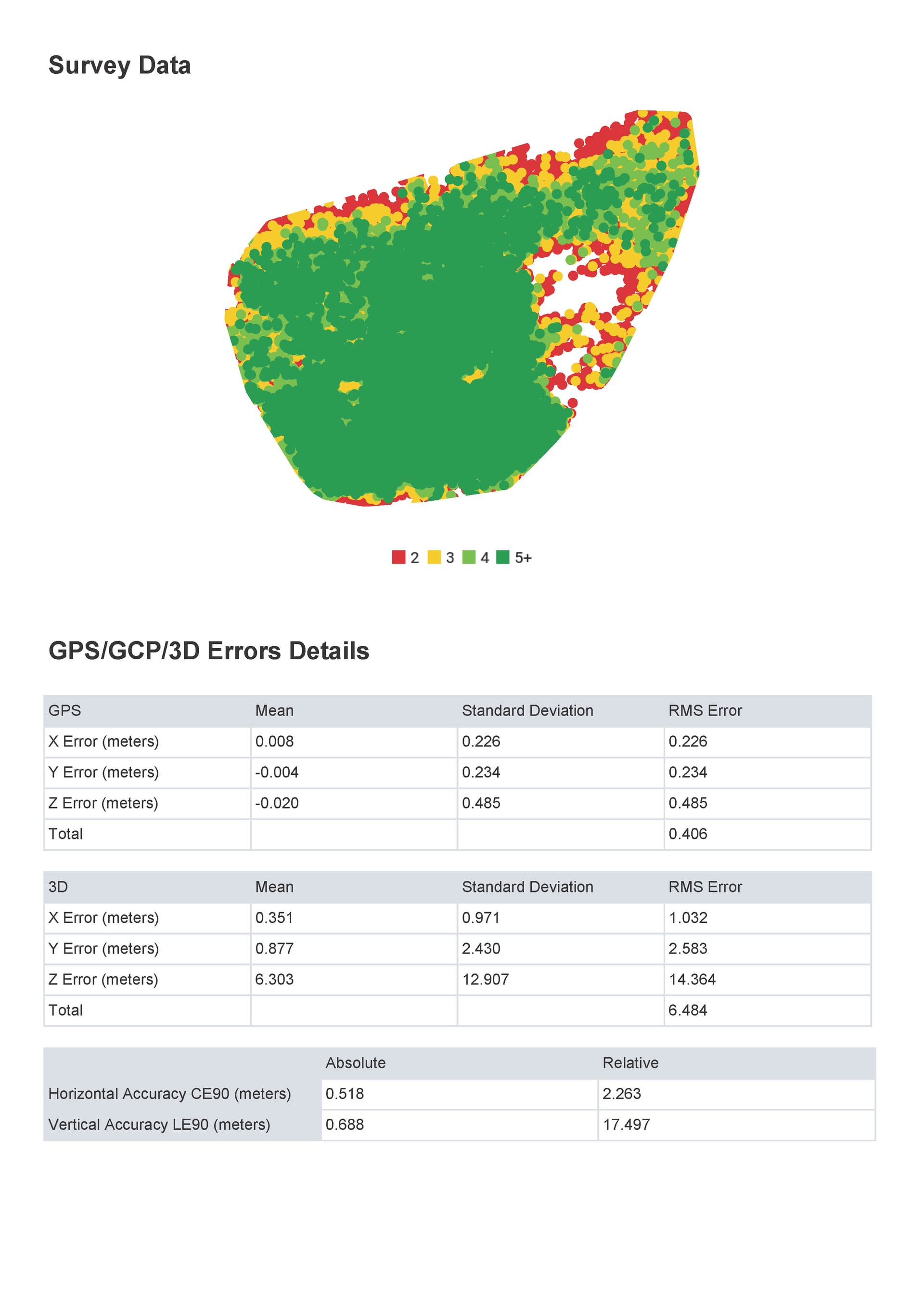
Area: forestry with different altitudes. At least I will get a high resolution ortho of all areas. At this time, I will process all separate and load these in QGIS. But on the borders there are artifacts. So perhaps it will be better to add pictures from other areas to one big photo.
Or what about align function? Is this feature the right thing and in windows native version also available?