New to the community, wanted to express my appreciation for the great work going on here!
I’m working with an initial data set collected with a Matrice 100 with a Z3 camera. The data set was collected using the planning functions in Map Pilot, using 80/80 overlaps at an altitude of 60 meter. The complete data set is 174 images, and I am working with the first 21 images as a small test set. The site is an open field area with a small water channel running down the middle.
I was successful in using WebODM to process the data set using default setting for everything except the following:
min-num-features: 8000 (increased from 4000 per WebODM after Code 1 crash)
force-ccd: set to 6.16 (after WebODM error indicating ccd width not found)
dem-terrain-type: set to FlatNonForrest (seemed like the closest description)
use-25dmesh: Enabled (did this when I was trying to solve Code 1 crash then just left it enabled)
use-pmvs: Enabled (per suggestion with Code 1 crash)
When I reviewed the results, I found two issues that I am trying to understand.
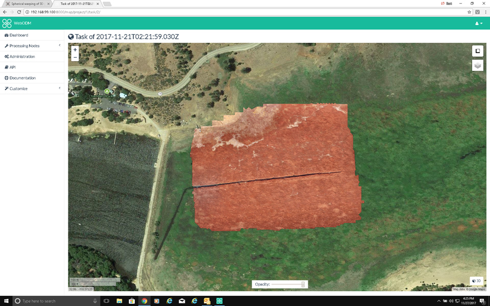
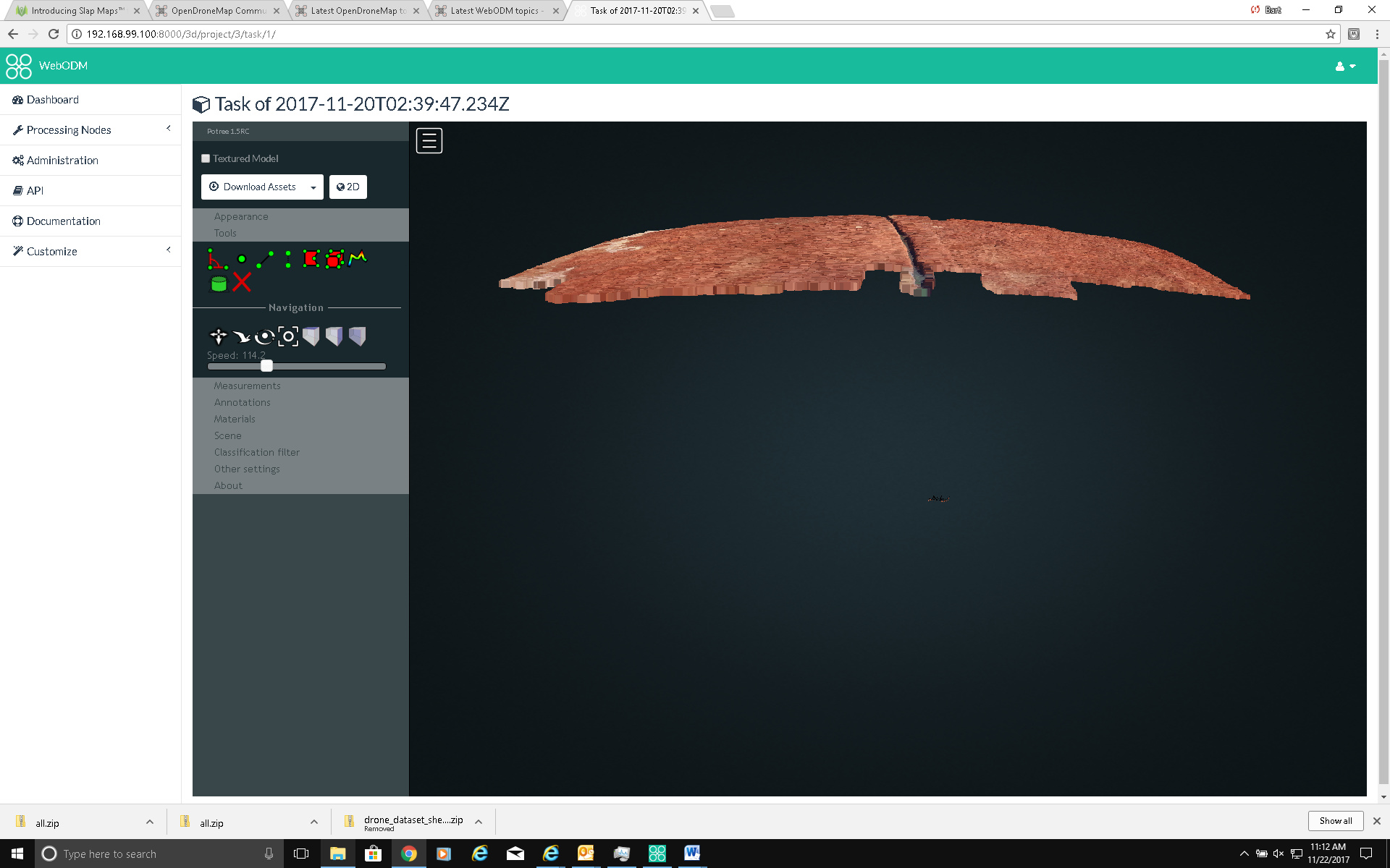
- In the 3D model, there appears to be a spherical warping of the surface that is not consistent with the terrain. This shows up in the small test data set as an upward arcing of the middle of the data set surface. When I run the larger data set, it is more obvious that the high point is in the center of the data set, with the rest of the surface arcing downward toward the edges.
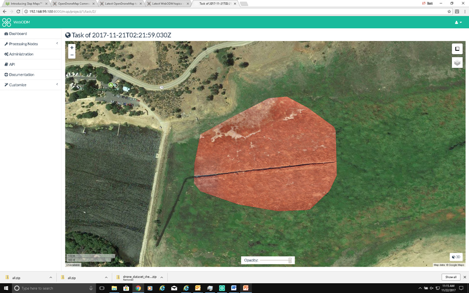
- There is a significant amount of clipping of the final orthophoto on the corners. This is not extreme in the small data set, but gets significantly more pronounced when I process the full data set.

These are probably two separate issues but thought I would include them together in case they were related.
The data set and results for the small data set are available at:
https://drive.google.com/open?id=1PUakBcn9ajDJUH_-1jkfhCLx0yAOZElK
Would really appreciate any insights on this!