Our company started to use drones for some of our projects early this year. They have been mostly used for documentation and tracking the contractor’s progress. One of our employees has been using Skydio 2+ drone on his project.
At the recommendation of one of our more experienced pilots, we are thinking about purchasing a drone with RTK so we can start to check and verify the contractor’s stockpile calculations. I am also new to using drones and trying to learn more about them.
The employee with the Skydio drone sent us an email (that I have posted below and attached referenced image). I am hoping to get some feedback from the community to see if this email makes sense. From my take on this email, I would certainly want to see if the parcel layer is that accurate. From my understanding with an RTK drone, you would want to use a couple of GCPs. Could you use the GCPs to help “line up” the parcel map in coordinate space.
Do all the layers in the map have to have the same accuracy as the RTK drone?
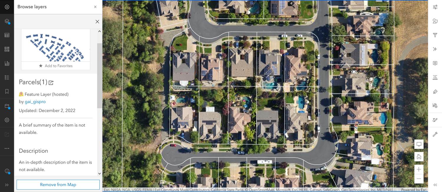
Here is an example of a very nice looking non-RTK drone orthomosaic shown with a portion of a countywide parcel layer overlay. The orthophoto is locally accurate, but it is not quite lined up in coordinate space, if the parcel layer is assumed to have a higher level of accuracy.
An RTK drone image would probably map closer to the parcel lines, but wouldn’t necessarily line up exactly since the countywide parcel shapefile isn’t mapped to centimeter accuracy either.
If we start using an RTK drone or phones with enhanced GPS antennas, we need to be aware of the scale we are working at, and the relative accuracy of data collected from each device or shown on each data layer. It makes little sense to use an RTK drone unless every other layer is also collected to the same level of accuracy. For instance, a data point taken with a Trimble Nomad GPS (2-5 meter accuracy) may not show well on an orthophoto with centimeter accuracy.