I just found out today that there is a WebODM plugin to upload to OpenAerialMap (thanks, @ralley). I enabled the plugin, but don’t know how to configure my authorization or Upload the GeoTiff. I’ve searched the documentation, but have found nothing.
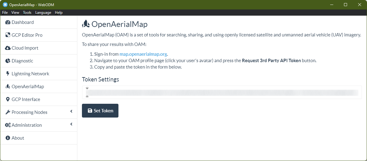
The plugin’s landing page has the instructions for usage, and where you’ll need to confirm your API access token to actually connect to the service, so using this landing page is critical for setting it up.
Click the link to sign in using either Facebook or Google authentication [no other options, though I opened a feature request for such a few years ago upstream with OpenAerialMap]
Click your profile picture, click Request 3rd Party API Token
Copy the block of text from below the Request 3rd Party API Token button
Paste the block of text into the Token Settings text field in WebODM
Nah, not a problem! Like you said, this needs to be in the docs. You gave me a kick in the rear to write it up here so that I can rework it for the actual docs next
Thanks for confirming that we had a gap there (and that this was clear enough to work for you!)
And not specific to you, but if anyone comes across a gap in the docs, please post. I’m bookmarking all the stuff folks are noting is missing and adding it to my (ever-growing) list of areas I need to document and publish for everyone.
Saijin, just so you know what I missed… Once I enabled the plugin, OpenAerialMap showed up on the left side of the main page. Quite obvious, but that wasn’t where I was looking for it and I didn’t see it (like I said, right in front of me). Once you pointed it out, the instructions in the plugin were easy to follow. Thank you again for such wonderful support!