Hello All, I tried to find the answer but I couldn’t, so can someone help me please?
I tried to georeference my data into Web ODM, I have 54 photos that were taken with P4RTK in wgs84. Also, I have 4 GCP that are measured with Leica GNSS with high accuracy in MGI Balcan Zone 7, 3909 projection. So I imported my photos and GCP files, here is the GCP file:
+proj=tmerc +lat_0=0 +lon_0=21 +k=0.9999 +x_0=7500000 +y_0=0 +ellps=bessel +towgs84=682,-203,480,0,0,0,0 +units=m +no_defs
P5 7470624.171 4957581.806 75.860
P4 7470610.376 4957657.757 74.494
P3 7470638.068 4957637.062 73.884
P2 7470655.232 4957600.463 73.907
Proj.4 is supposed to be for EPSG 3909 and 6316 (It is the same file).
After that, I got the file gcp_list.txt
+proj=tmerc +lat_0=0 +lon_0=21 +k=0.9999 +x_0=7500000 +y_0=0 +ellps=bessel +towgs84=682,-203,480,0,0,0,0 +units=m +no_defs
7470655.23 4957600.46 73.907 4228.77 754.12 100_0822_0001.JPG P2
7470655.23 4957600.46 73.907 4158.23 1299.35 100_0822_0002.JPG P2
7470655.23 4957600.46 73.907 4140.98 1964.08 100_0822_0003.JPG P2
7470655.23 4957600.46 73.907 4101.61 2647.08 100_0822_0004.JPG P2
7470655.23 4957600.46 73.907 2845.68 545.03 100_0822_0018.JPG P2
7470655.23 4957600.46 73.907 2… 42 lines in total…
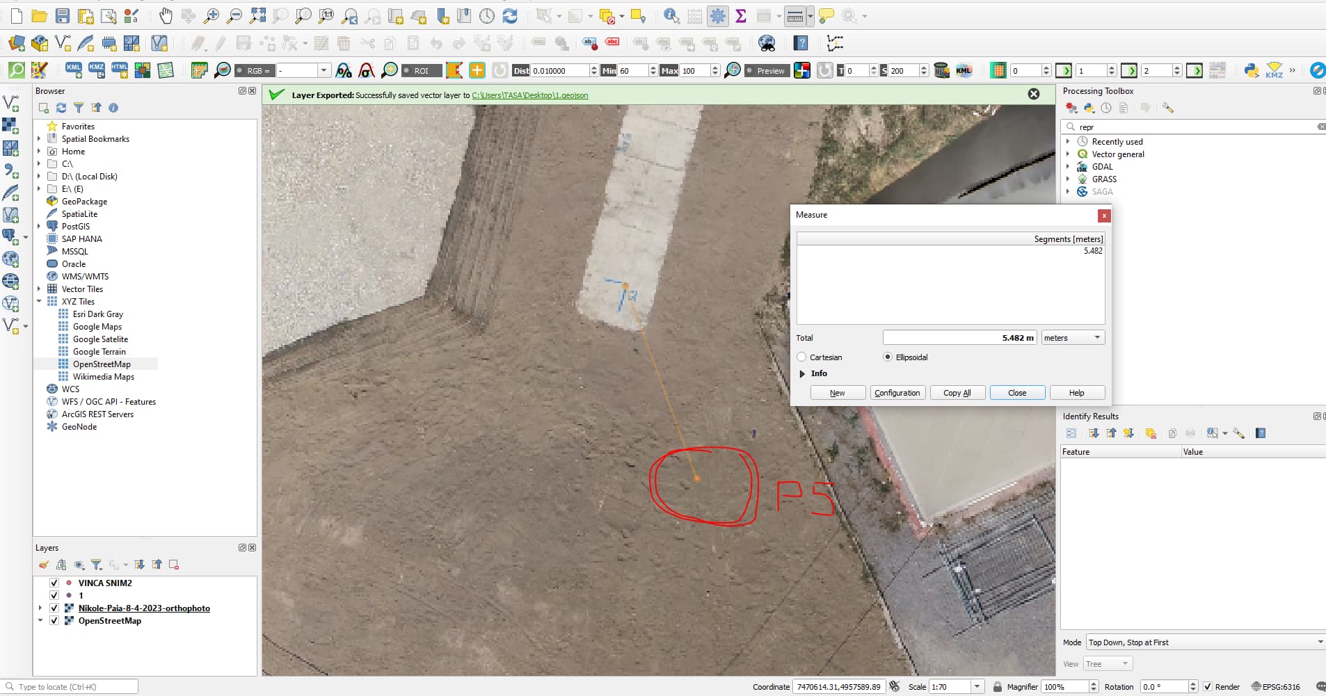
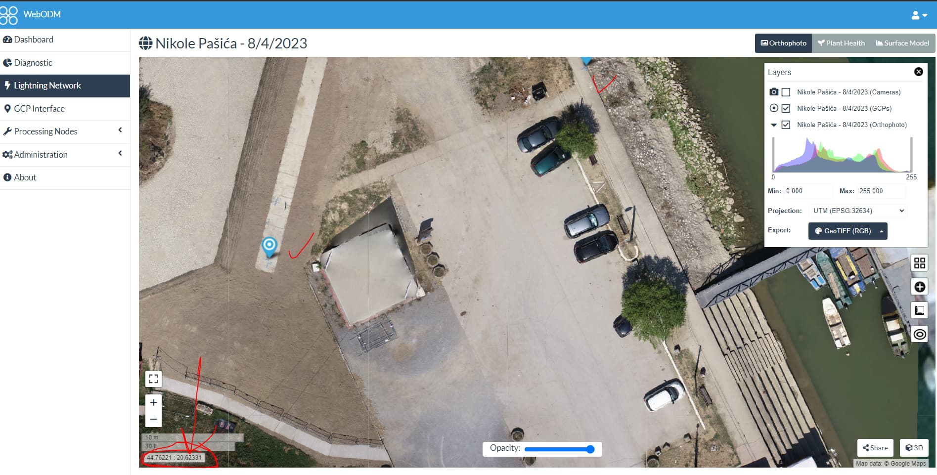
After that, I ran processing (I selected all images and file_gcp at the same time and uploaded), after processing was done, I could see that everything looked good, in the report GCP are under 1cm in the orthophoto GCP is on my markers, but in the left corner, I see coordinates that are in WGS 84, so why are not in my projection?
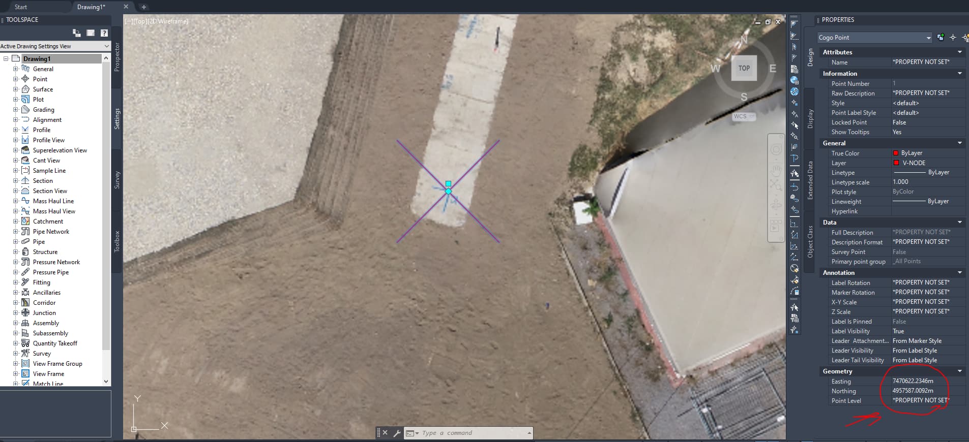
I exported the orthophoto with EPSG 3909, and after I uploaded it in QGIS I noticed that CRS is 6316 (why)…I uploaded my GCP and I could see that the markers are about 5m away from GCP points, although in WebODM UI were in a good place
I also exported Ortophoto and GCP in the same projection 3909 (also 6316) and again GCP is not on markers on Ortophoto, 5m far are.
I checked the exported GCP geoJSON file and saw that points are in WGS84 (Why since I imported them in my CRS)
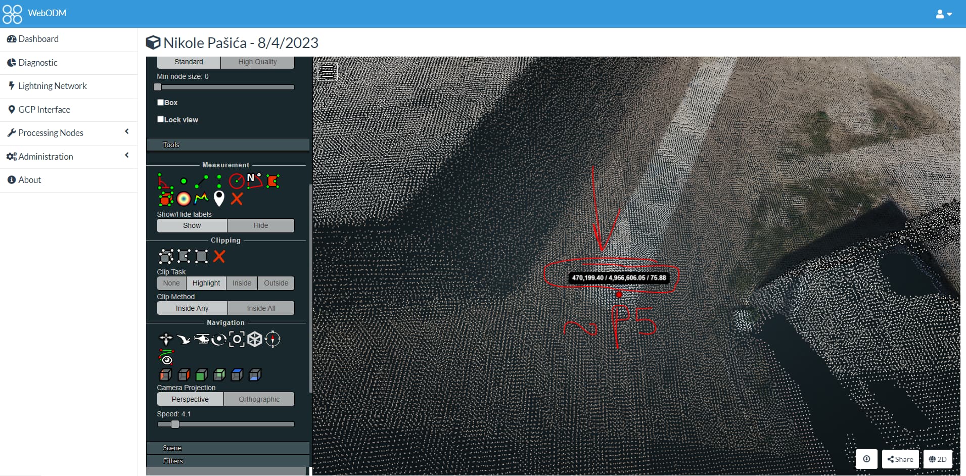
Also in Point Cloud I saw that heights are good but some strange coordinates are shown when I place points on my marker in Web ODM UI and compare results with my coordinates for this marker.
Also, I exported LAZ, and the same as Ortophoto, 5m away from markers for each point…
So my question is, did I do something wrong during georeferencing, or during exporting, or is there maybe some problem with 3909/6316 CRS?
gcp_list.txt (2.7 KB)
Thank you in Advance