Did you also processed a pointcloud? If so, you could check where your gcp is located there… I sometimes experienced gcp-offset in the orthophoto compared to the report due to image-artefacts in areas of low overlap. But when checking the pointcloud data the gcp-center was actually at the right spot..
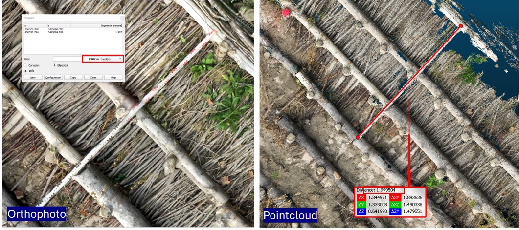
Here an example of measuring a 2m bar in orthophoto (measured in QGIS: 1.91 m long) and in a pointcloud (measured in CloudCompare: 1.9995m long) of the same dataset / processing run.