Hi All,
I have tried several ways to input my GCP’s, and ODM accepts most of them, but is always leaving me with very random points on the map. Here’s the raw info that the surveyor gave us:
I’ve been playing around with QGIS and trying to locate your shared points. However, I noticed that the CRS (Coordinate Reference System) might not be quite right (I tried 36N and 36S [UTM/WGS84]). I’m not sure if you’re working near the Antarctic or southern Egypt, but it might be worth double-checking with the surveyor to make sure everything is accurate.
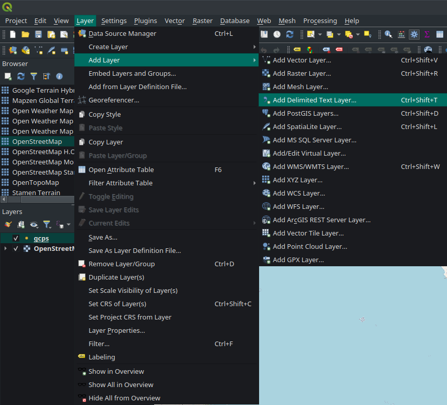
I’ve attached some screenshots of the results and a quick guide on how to map GCPs on QGIS.
Results of CRS: WGS84 UTM 36S → somewhere near the Antarctic
Hi Mike,
We got given a excel with a 12 points marked by the surveyor. Long/Lat & Alt. We then manually created our .txt document. Maybe this is the mistake??
Hi ayoubft,
I think you are right, we initially took this information from the ODM georenferenced text document that is created through one of the map processing exports. Seems maybe that is very wrong as we also got Either Egypt or Antacrtica, where as we where working in South Africa.
I will study what you have attached and see if i cant get better understanding of where iv gone wrong.
Thank you for feedback and Info. I will revert back soonest!
The coordinates in your first post are not Lat and Long. As ayoubft said, you should verify the datum and CRS with your surveyor.
There are two different files for the GCP’s, first the control file which looks like what you posted. It shows the coordinates and elevation of the control.
The GCP_list.txt file shows the same control points along with the raw photo pixel coordinates of the control markers and the photo file name.