Great initiative, nice work!
Maybe some nice features to consider?
XYZ Tiles RGB / DSM / DTM
Now a user needs to upload a GeoTiff (RGB / DSM). It would be nice to add a XYZ Tiles url / schema as well. So that webbased mappings can be embedded directly.
Is see that the demo.webodm.org link is down, if you need an example (hosted) layer please let me know I can DM you one.
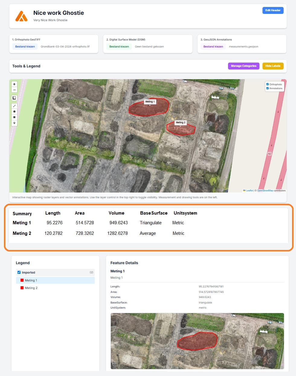
Summary
It would be very nice to see a “summary table” of all the measurements / annotations in one view.
So that a user can see a complete overview. I did some freestyling in Paint ![]()